|
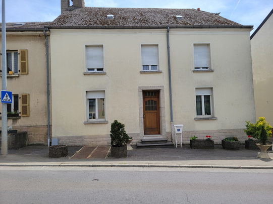
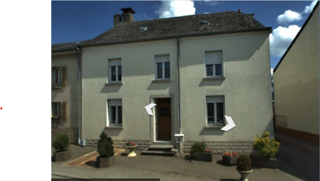
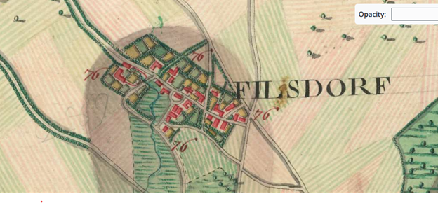
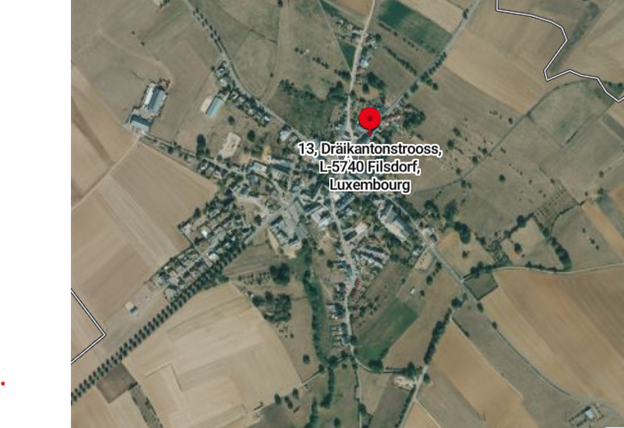
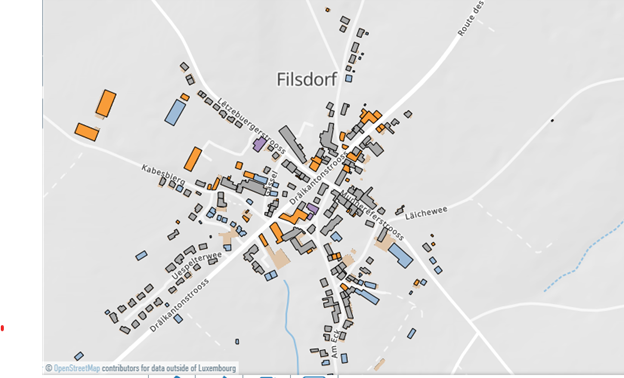
In a previous blog we talked about house names which are different than the house numbers we typically use for addresses. In fact, the name of the house might not have anything to do with our family surname or might have been the reason that our family surname was changed to match the house. I have been looking for older maps to better understand what a village in Luxembourg might have looked like when my ancestors’ lived there. I thought I’d share useful map links for your quest. Let’s look. You’ve likely used Google Maps or Bing Maps to get directions. Have you tried to use these to better view where your ancestors lived? The Birdseye and street views allow you to see buildings as they are today. If you’re lucky, you might be able to see the actual home of your ancestor. To provide consistency, we’ll use the village of Filsdorf, Luxembourg in this blog. A cousin found her ancestral home in this village. And snapped this photo of number 13. The house has a family name noted along with the number. If we look in Bing Maps, we can find Filsdorf, Luxembourg and view the village. I tried the streetside view but could not find the home without the street information. I then searched for the last name using the Luxembourg phone book. For privacy I will not include the name, but the street address was 13 Dräikantonstrooss 5740 Duelem - Filsdorf Remich – Grevenmacher. And going back to the street view on Bing maps with the complete address, I found the house! Imagine how much easier this is when you have the address of your ancestor! Now it would be fun to see if we could find this same home on an older map. After trying to find cadastral maps for Filsdorf, I found that I had better luck by first going to Bestände | Matricula Online (matricula-online.eu) which is a free online site to search church records in Luxembourg. Filsdorf is a small village, so I know that their records include the village of Dalheim. By choosing Dalheim, I can see that there is a modern and an old map of that area. By clicking on the old map, you are taken to this site: Belgium /Ferraris/ (1777) | Arcanum Maps. By adjusting the map, I can see the village of Filsdorf as it looked in 1777. While I can’t view at the streetside level, I can see where buildings are and can compare the streets to what is available today. While I have no way of knowing if my building is there, it’s interesting to see how the village has expanded and yet retained much of its form. For reference, here is the view of the village, using Bing Maps. Bing Maps - Directions, trip planning, traffic cameras & more Another interesting site for viewing Luxembourg is Main - Geoportal Luxembourg (geoportail.lu) You can enter an address and then choose what you’d like to see on the map. In this example I chose buildings and if we zoom in, we can view the village with the streets and shapes of the buildings. I hope this has given you some ideas for searching for your ancestors’ ancestral homes. This example focused on Luxembourg but with a little digging, you might find similar resources for your country of interests. While we are not always lucky to find the actual ancestral home, we can still have a better understanding of what their village or the surrounding countryside looks like. Happy exploring!
0 Comments
Leave a Reply. |
AuthorWith a lifelong passion for genealogy and history, the author enjoys the opportunity to share genealogy tidbits, inspiring others to research and write their family story. Archives
July 2024
Categories |
 RSS Feed