|
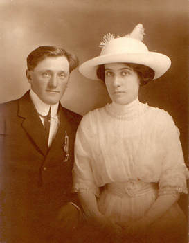
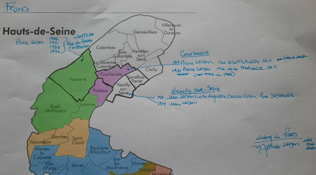
In past blogs we’ve discussed the need to look beyond our direct ancestors and explore their siblings and other relatives. I have been doing that recently with my great grandmother’s siblings who moved to Paris from Luxembourg. Let’s look at how maps are helping my research. My great-grandparents were born and lived in Luxembourg until they traveled to America. At least that was what I thought until I discovered their wedding picture from a photography studio in Paris, France. As more records became available on Ancestry, I found their wedding banns, and information that helped me find their actual marriage record. And until I started researching my great-grandmother’s siblings, I assumed that it was a fluke or romantic gesture that they married in Paris. Once I started to research those siblings, I realized that her entire family had moved from their hometown in Luxembourg to Paris, France. While my ancestor moved back to Luxembourg with her husband, her siblings stayed in France and raised their families there. A little aside about French records. The Paris Archives online have an abundance of birth, marriage, and death records but you need to know the Arrondissement where the event occurred. Usually, the event happened where they lived. Sadly, in Paris the census records don’t start until 1926 and are not indexed on this free site. So, while in the United States we bemoan that the 1890 census is missing, we are lucky that we have indexed and searchable census records. Fortunately, if your ancestor lived outside of Paris census records are more readily available for years prior to 1926. The archives that are online and free do not have these census records indexed. If you find yourself researching in a city or country and trying to figure out where your ancestor lived, pay close attention to the birth, marriage and death records of the individuals and their children. Also note where the witnesses lived as they might be relatives or a sibling. Often grandparents resided with one of their adult children. Another reason to research those siblings. By understand what part of Paris and surrounding areas that they lived, I was able to map out the family. In addition, if I had information from their children and their marriages, I could note the parent’s locations during those events. Why is this important? My goal was to discover the death records of those siblings and their spouses which I couldn’t do until I could narrow down their location in time. Unlike my American farm families, these people did not stay in the same place and did not appear to own a home. Sometimes they were in a different location with each child’s birth! To give you an example, imagine that you know your family lived in New York City, but you do not know where and there is no city directory or census record to narrow your search. With unlimited time, you could trudge through endless records trying to find them. And while I love researching, no one has unlimited time. What can you do? I started with the records that I did have—marriage records that were indexed from Ancestry and included the street addresses. A quick online search provided me with which Arrondissement the address was found. Then I found their children’s births and noted those addresses. Were they still in Paris? If not, had they moved to one of the suburbs of Paris? If they had then there might be census records, there or additional records related to the family. Could I do this research without a map? I suppose but I am better able to see visually where the gaps are in my research as well as identify opportunities to search other locations. By doing this I’ve discovered the families in census records, death records and marriage records of children because of the clue contained in the maps. By using a map with the locations of these siblings, I could see how close they lived to each other, determine where the records might be, and gain insight into family dynamics. One family seems to live south of Paris while the rest were clustered in nearby suburbs. Was there a falling out? Or did the type of work by the husband dictate their location? I might never know. You can view addresses using Google maps, sometimes with a streetside view. In one case, the area looked seedy, and I plan to dig into local history to better understand this suburb. There was no longer a building at that address. Here’s an example of one such map. The purpose is to help you research by viewing the data differently. Using a map of the location, I added the names and dates that they resided at a particular address. It doesn't have to be fancy--just a way for you to see where they were at a given time. I could elaborate and put source information. Remember when doing this for yourself, it is your map and your family so do what works best for you. Try mapping your ancestor’s siblings’ locations. Or map your grandparent’s farming neighborhood with the locations of relatives that lived nearby. You could even do this using your own siblings. The purpose of the exercise is to look at the data you have collected differently. I hope this exercise helps you find new ways to explore your family history. Happy mapping!
0 Comments
Leave a Reply. |
AuthorWith a lifelong passion for genealogy and history, the author enjoys the opportunity to share genealogy tidbits, inspiring others to research and write their family story. Archives
July 2024
Categories |


 RSS Feed