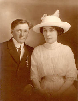
Leave a legacy...write down
the history of your family.
|

|

|
|
|
|
|
|
|
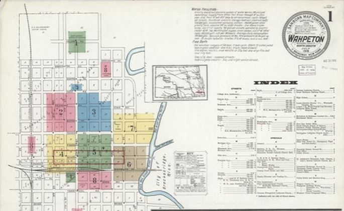 I’m reading a fictional novel that has one of the main characters “mind map” his way through 1880s New York City. In the novel he can vividly see what buildings, streets and structures looked like at that time as he “walked around” in his mind. While few of us would have the knowledge and ability of this fictional character, we can use tools to help us understand what a town or location might look like. The Sanborn Fire Insurance Maps are a genealogy resource that can help us. These maps were created by the Sanborn Map Company and cover various years in different cities across the United States. It’s intriguing to think about where our ancestors lived or shopped or went to church. Or even to understand what types of businesses were around when our family lived there compared to what is available today. Let’s look at how to find the Sanborn Fire Insurance Maps and ways to use them in our family story. The good news is that many of the Sanborn Fire Maps are available online for free. The less good news is you might not find them for a smaller town or city in every state. Let’s walk through an example using the government archives. You can find the Sanborn Fire Insurance Maps online at the Library of Congress. A portion of these maps are available online and others you would need to visit the Library of Congress reading room to view. Take a minute to read the about this collection to understand what is available and the color keys for the maps. For example, pink buildings indicate that they were made of brick while yellow would be a frame building. There are also indexes of streets and information about the fire department. From the main page of the collection, you can choose which state you want to search and then which county from the list on the left-hand side of the page. As an example, I chose North Dakota, then Richland County and finally chose the town of Wahpeton and the Jan 1898 maps. 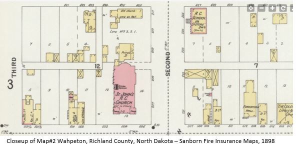 Here’s a screenshot of a portion of page two from this collection. I’ve zoomed in on St. John’s Catholic Church. This is of interest to me because my ancestors attended this church from its early days. While this map was created for fire insurance, it is interesting to see there are two towers noted on the building of the church as well as a note that it has a steam heater. There is another building called “old church used as a hall” on the backside of the block plus other businesses along that main street. There are maps available for the years 1884, 1886, 1891, 1904, 1910, and 1916 for Wahpeton so if there was a business or building you were interested in, it might be fun to compare the maps to see what has changed over those thirty years. 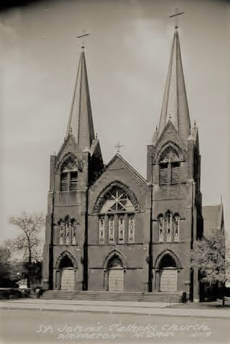 And usually on the first page of a map set, there is information about the town and their fire department. Here is Wahpeton’s information from 1886. 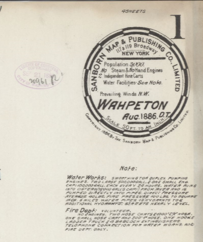 In the 1891 maps, there is a note “the entire block burnt on May 30, 1891.” There are many missing buildings on that block that were there in the 1886 maps. What if your ancestor had a store or business in that area? Are there family stories about a fire? Perhaps it is long forgotten as the years have passed. By 1904, more buildings have notations that they have “lights, electricity” including our example, St. John’s Church. And there is an electric company on the main street of Wahpeton.
Ways to view these maps:
The focus of these maps is for fire insurance but aren’t we glad that they created them for those of us who like to “stroll around” and see what things were like in our ancestor’s town? “There must be something innate about maps, about this one specific way of picturing our world and our relation to it, that charms us, calls to us, won’t let us look anywhere else in the room if there is a map on the wall.” --Ken Jennings Comments are closed.
|
AuthorWith a lifelong passion for genealogy and history, the author enjoys the opportunity to share genealogy tidbits, inspiring others to research and write their family story. Archives
July 2024
Categories |
 RSS Feed