Leave a legacy...write down
the history of your family.
|

|
|
|
|
|
|
|
|
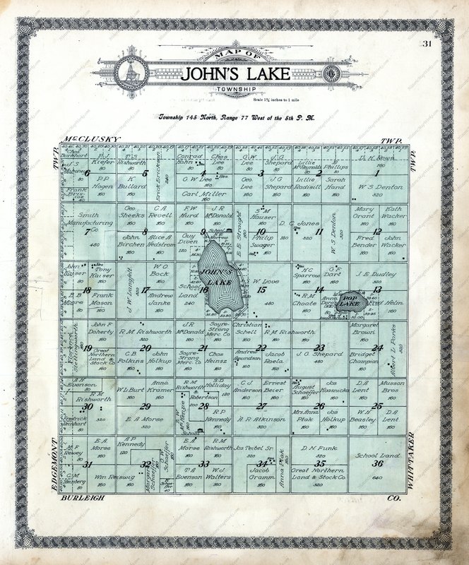 Land has been a motivator for migration for centuries. Measuring land, surveying land and homesteading land were key activities that drove the settlement of land in the United States and Canada. The settlement patterns of the “west” were shaped by how the land was measured. The six (miles) by six (miles) townships created communities within the counties. While the definition of the “west” changed as settlers continued to move further west, the underlying motivation remained the same. People were looking for a way to improve their lives and care for their families. In Land Ho! I talked about the great information that we can discover in homestead records. We can find information such as the type of home build, crops planted and neighbors who testified on behalf our relative. Let’s look at how the way land was measured and plotted impacted our relatives. When the United States was first settled on the east coast, large tracts of land were given to people who helped the king or provide service in some other way. They, in turn, granted parcels of this land to others for money or service. The parcels did not follow an exact grid because of the topography of the land. For example, your parcel might have a creek as a boundary on one side. Everyone who lived in the vicinity knew about this creek and it made sense to the locals. However, when we start trying to figure out the legal land description in present time, it is a bit more challenging. Plat maps can be compared from the time of your ancestor (if one exists) to present day. As the country expanded west and the railroads and homestead act of 1862 further fueled settlement, the need to survey, measure and create boundaries was more important than ever. Once expansion had reached into the great plains, surveyors must have been happy to use the rectangular system of survey.
How land was measured in the grid system.
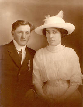
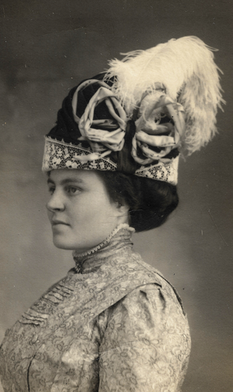
So how did this original model influence our ancestors? Unlike today with the larger farming operations, back then, it was more common to find four families on a section of land, each farming their 160 acres. It was not uncommon for family farms to be set up in a corner of the quarter of land. My relatives had adjoining quarters and their farms were right next to each other where the corners met. With rural phones uncommon and travel primarily by hoofs or feet, they wanted to live nearby. People learned quickly that they needed each other. Almost everyone was in the same situation…they needed to build a claim shack, start tilling the land and toughing it out for the required homestead period. Farming was risky busy with many things out of their control—prices, insects, natural disasters and other expenses. You looked for ways to save by helping your neighbor who would also help you, trading expertise, manpower or equipment. Look at how your family fits into this western movement and think about what their experiences may have been. Look at old plat books and see where neighbors’ farms are located compared to your family’s. Did some of the neighbors come from the “old country”? Or from the same town from the east? Do you have any stories about the early years? What about the “dirty thirties”? Look at old photos—they may tell their own story about threshing, livestock or living conditions. Here are a few resources about land and surveys that may interest you.
As you look at land records with new eyes, you’ll notice how many neighbors and family clustered in a region. It makes sense as they were gambling that they could make a better life by heading west to homestead, moving away from family and friends. Have fun exploring the six by six (miles) townships of your ancestors! There's a magical tie to the land of our home, which the heart cannot break, though the footsteps may roam. --Eliza Cook Comments are closed.
|
AuthorWith a lifelong passion for genealogy and history, the author enjoys the opportunity to share genealogy tidbits, inspiring others to research and write their family story. Archives
July 2024
Categories |
 RSS Feed